

The Indian Ocean has been a hub of trade as far back as we have records. Merchants have long traveled its coastlines and—in ancient eras where leaving sight of land was often a death sentence—taken advantage of its predictable annual monsoon winds to cross the ocean itself in long, daring journeys. While we know ancient Mediterranean people sailed the Indian Ocean far from their homelands, only one account of their travels survives: The Periplus of the Erythraean Sea. The periplus is a remarkably prosaic document, with none of the “here be dragons” found in later European travelogues of distant lands. Yet it contains some really cool stories with surprisingly gameable details. Let’s take a look!
This post is brought to you by beloved Patreon backer Justin Moor. Thanks for helping keep the lights on! If you want to help keep this blog going alongside Justin, head over to the Patreon page – and thank you!
The text probably dates to the first century A.D. It’s written in Koine Greek, the lingua franca of the eastern Mediterranean world, suggesting the anonymous author hailed from somewhere in that region or was writing for that audience. The author was perhaps most likely a member of the ethnically Greek upper class in Egypt, but that’s far from certain. The ancient Greeks gave the name “Erythraean Sea” to what we call the Indian Ocean, though many—including the author of The Periplus of the Erythraean Sea—also included the Red Sea and the Persian Gulf in the phrase “Erythraean Sea.”
A periplus is a sort of seacoast map in words, written instead of drawn. The text of a periplus starts you in a particular location along the coast, then says, “If you sail in this direction, here are the ports and landmarks you come to, in the order they appear.” Given that most ancient sailors followed the coast, a periplus was a very handy navigation aid. It demonstrated exactly where you were along the coast by what landmarks you had passed getting there. A good periplus also listed distances, navigational advice for entering harbors, warnings about the local weather, and lots of juicy details about what you might find in different ports. I wrote about a fraudulent periplus of the Caspian Sea back in 2022.
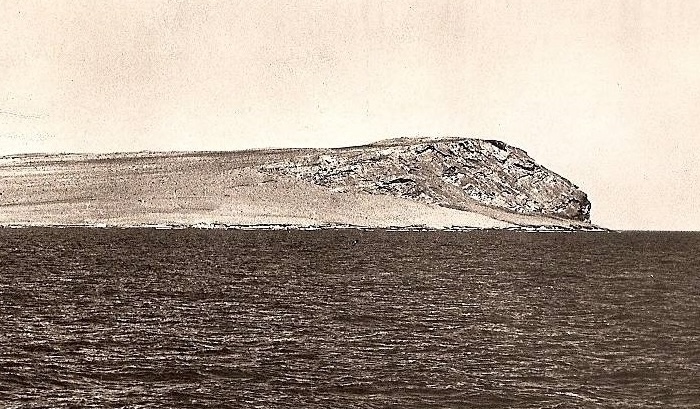
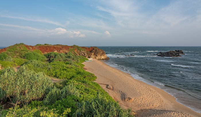
Cape Guardafui, the very tip of the Horn of Africa in modern-day Somalia, is marked by a rocky headland and high cliffs. In the periplus, a port on the north face of the headland called the Mart of the Spices. The harbor is exposed to the north wind. When a storm with north winds approaches, the deep of the sea grows disturbed and changes color. Sailors in the know then raise anchor and round the headland to the other side, taking shelter in an anchorage that is exposed to the south wind but protected from the imminent north wind.
At the table, if the characters are in a port whose geography is based on the Mart of the Spices, the weather changes as described above. They now have a ticking clock; they have to make safe anchorage before the storm arrives. Clocks in the style of Blades in the Dark are a great way to model this. The party has to make it swiftly through the swirling crowds of the port back to their ship and raise anchor. The characters can certainly speed their way through town if they frighten people out of their path by shooting guns in the air or somesuch, but later they might have to deal with the consequences. In the harbor the characters must deal with the crowd of ships all trying to leave at once. Do they wait patiently and politely for their turn, or do they jostle other ships out of the way, potentially damaging their own ship or other ships in the process? After all that, if they make it to the protected anchorage in time, they are then surrounded by the very ships they might have been jostling with minutes earlier, potentially leading to verbal altercations, lawsuits, a damaged reputation, or combat, depending on your flavor of campaign.
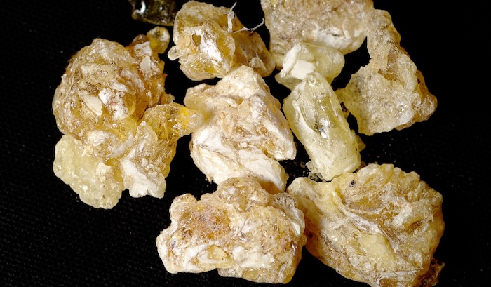
You can further complicate this scenario with a detail from a port near modern Salalah, Oman, which the periplus author tells us exports frankincense. The port’s mole (solid stone pier for loading and unloading cargo) is ancient and ruined, though still very much in use. The royal harbormaster leaves the mole unguarded, despite the great value of the frankincense taken on there, because the gods themselves guard that particular mole. If so much as a grain of frankincense is aboard a departing ship without permission of the king, the ship simply cannot sail, for the gods have forbidden it. If this is also a harbor that needs to be periodically evacuated as at the Mart of Spices, playing “hide a grain of frankincense” on the ships of your rivals—and having them play it on your ship—could be a great complication.
In the mangrove forests of the Rufiji Delta, in modern Tanzania, the periplus describes the pirate town of Rhapta. The town exports pirate plunder, especially ivory and rhinoceros horn. Its chief import is weapons: swords, axes, and spears. The pirates pay tribute to whichever power is ascendent in the western Indian Ocean. At the time the periplus-writer visited Rhapta, that was a good-sized kingdom headquartered in southwest Yemen. As a consequence of this relationship, most of the trade in Rhapta comes from Yemen. This delicate relationship between the pirates and their nominal suzerains is an interesting one, and—I think—gameable. 1,500 miles lie between the pirates and their overlords. If the characters want to sway Rhapta’s city fathers to a different, more profitable set of suzerains, they might be able to take a cut of the trade deal and earn the enmity of the king in Yemen.
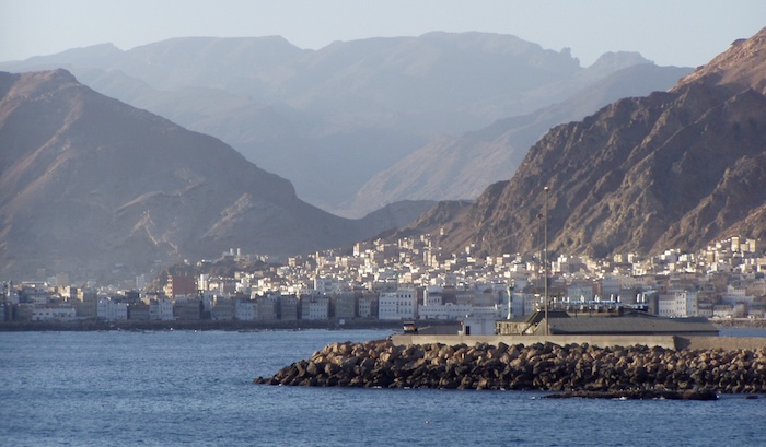
In Yemen, along the bay that includes the modern city of Al Mukalla, there are trees that bear frankincense. The region is terribly unhealthy. The periplus author says you risk disease even just sailing past it. Consequently, the frankincense is harvested by condemned criminals and slaves, all of whom die while they work, hastened along by a lack of food. Obviously at the table, the characters have to rescue a friend who’s been condemned to the frankincense groves.
Credit: Dan. Released under a CC BY-SA 2.0 license.
The port of Barugaza (modern Bharuch) in Gujarat, India, lies at the back of a very treacherous bay. Barugaza is a wealthy and desirable port of call, as a great deal of valuable trade goods from farther inland are funneled here, but reaching the port from sea is dangerous! The mouth of the bay is rocky and has a strong current. There are shoals in the bay near the city. And the tides, the periplus author tells us, can be rapid and extreme. When the tidal range is largest, low tide reveals large sections of the ocean floor. High tide causes rivers that empty into the bay to overflow their banks. Ships that aren’t prepared for the current of the tides are driven onto the shoals or are suddenly turned sideways and capsized. For this reason, boatmen in the employ of the king work as harbor pilots. They go out in shallow-draft, rowed longboats to guide ships in safely and to tow them like tugboats when necessary.
This presents the opportunity for trouble. What if the pilot assigned to your vessel doesn’t get along with the sailors and they fall to squabbling? What if then the pilot announces that there was a recent shipwreck in a spot that will be exposed by the tide during your transit. He’ll guide you there in exchange for a cut of any treasure looted from the shipwreck. The pilot plans to take his cut, then walk across the exposed seafloor to the regular shoreline and safety. When the tide comes in, it’ll capsize your ship, and all the obnoxious sailors the pilot dislikes will drown. The pilot’s friends on the nearby longboat are well accustomed to dealing with the tide and will be unharmed. How the situation actually plays out depends on what the characters get up to.
The periplus ends with the lands around the Ganges Delta (modern Calcutta), in eastern India. This description is vaguer and less detailed than most others in the periplus; I wouldn’t be surprised if the author never visited it. The author confidently tells us that the lands east of India are uninhabited and unexplored. What we would call Southeast Asia is a frozen wasteland.
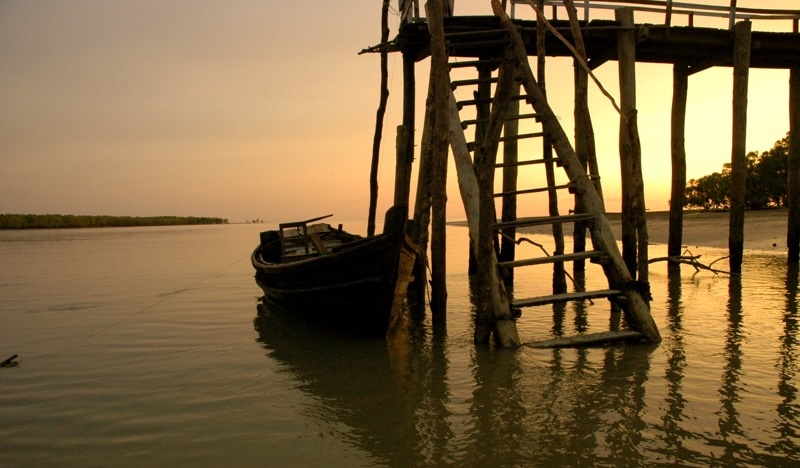
Image credit: bri vos. Released under a CC BY 2.0 DEED license.
Make sure you don’t miss a blog post by subscribing to my no-frills, every-other-week mailing list! I also have a signup that’s only for big product releases!
Looking for material for your game tonight? My back catalog has hundreds of great posts, all searchable and filterable so you can find something from real history or folklore that fits exactly what you need! Posts older than a year are behind a very cheap paywall – only $2/month!
Come follow and chat with me on social media! On Mastodon I’m @MoltenSulfur@dice.camp. On Twitter, I’m @moltensulfur. On Blue Sky, I’m @moltensulfur.bsky.social.
Enjoy this post? Consider sharing it on social media, or maybe emailing it to a GM friend of yours. The social media infrastructure that creators relied upon to grow their audiences is collapsing. You sharing my stuff helps me stay relevant and ultimately helps me get paid for my time.
Check out Shanty Hunters, my award-winning TTRPG about collecting magical sea shanties in the year 1880, then singing them at the table with your friends. The lyrics of the shanties come to life and cause problems for you and for the crew of the ship you sail aboard. It’s up to you to find clues in the song and put things right!
Source: The Periplus of the Erythraean Sea, translated and edited by G.W.B. Huntingford (1980)